 The canals
Main canals
Herengracht, Keizersgracht, Prinsengracht and Singel

Amsterdam has been in development for a millennium. 1,000 years ago, the Amsterdam we know today was just an insignificant fishing village. The history of the city begins in the 12th century, when the vast peat area south of the IJ was reclaimed. The region was given the name Amestelle and received city rights in 1306.
As protection, the young city was given an earthen wall along the Amsterdam canals on both sides of the Amstel, also known as a 'burgwal'. Initially, the names of these embankments were derived from the side on which they were located: Oudezijds and Nieuwezijds Burgwal.
Subsequently, around 1380, the city was further expanded and a second canal with ramparts was dug on the Old Side (Oude Zijde), the Oudezijds Achterburgwal. The next expansion began around 1420. On the east side of the city, a new fortification was built along the present-day Geldersekade and the Kloveniersburgwal. On the west side of the city, a moat (singelgracht) was dug.
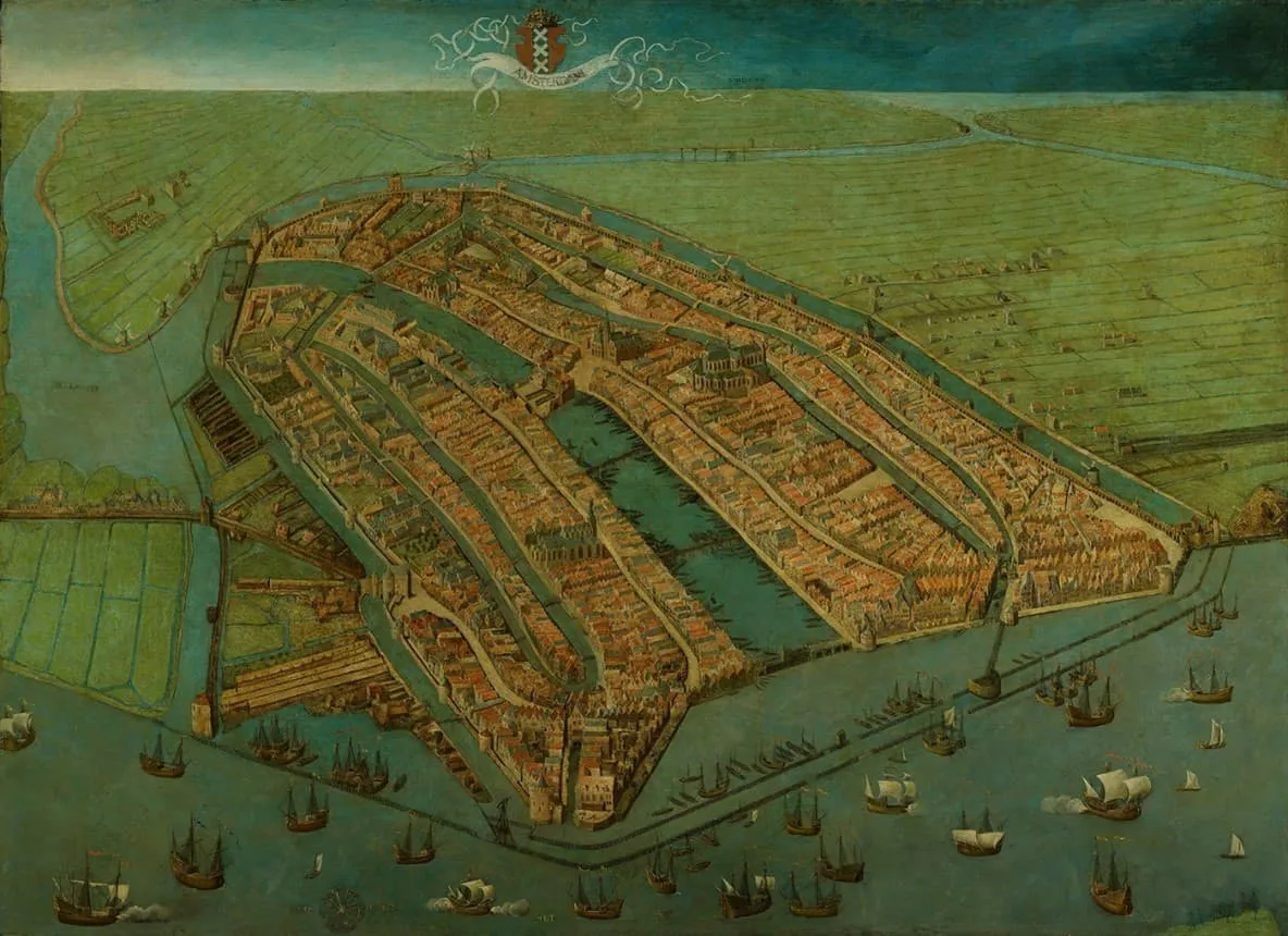
Bird's-eye view of Amsterdam, Cornelis Anthonisz., 1538. Amsterdam Museum
It soon became clear that these expansions were not enough for the growing city. In the years after 1585, Amsterdam was confronted with enormous population growth. In that year, Antwerp, Mechelen, and Brussels fell into Spanish hands. The year before, Ghent had fallen to the Spaniards. This turning point in the Eighty Years' War led to a stream of migrants from the Southern Netherlands to Amsterdam. The relative political and religious freedom and economic prosperity in the city also attracted many new residents. As a result, the migrants who arrived caused the population of Amsterdam to triple.
The city, which numbered 30,000 residents after this growth, was not prepared for this unprecedented increase in inhabitants. Therefore, the city council devised the plan for the first major urban expansion of the seventeenth century. This urban expansion took the form of a fan. This was chosen because a circular shape provided the largest surface area per linear meter of defensive wall. A semi-circular shape was also the most logical for a city on the water. The canal belt was laid out around the medieval center. Amsterdam had originated around the Amstel in the Middle Ages, and subsequent expansions of the city were therefore always accompanied by the construction of canals. Additionally, due to the marshy land, there was also a necessity for constructing canals.
Ultimately, on March 5, 1613, the city council, also known as the Vroedschap, made the important decision for a new urban expansion. This would initially be limited to the west side of the city. Two main canals were constructed: the Herengracht on the site of the old city wall, and the Keizersgracht. Following this, a new proposal for the city expansion was made on August 10, one with three canals. Based on this new proposal, the Herengracht, Prinsengracht, and Keizersgracht were dug. The Herengracht was dug starting in 1613, the Prinsengracht from 1614, and the Keizersgracht from 1615.
According to the city council, the new urban expansion of Amsterdam had to be not only beneficial for trade but also offer a beautiful and prestigious residential area. The first attempt at this began in 1585 with the addition of a new canal at the site of the current Herengracht. This proved insufficient to accommodate the population increase, and they proceeded to construct a series of streets and canals around the center.
It soon became clear that enlarging Amsterdam involved significant costs. Therefore, it was decided to construct the large ring around Amsterdam in stages. These stages formed the Third Expansion (Derde Uitleg), which began in 1610, and the Fourth Expansion (Vierde Uitleg) from 1662. During the Third Expansion, the western sides of the Herengracht, Keizersgracht, and Prinsengracht (from the Brouwersgracht to the Leidsegracht) were created. The new city integrated parts of the existing suburb. Later, this neighborhood was given the name Jordaan.
In the Third Expansion, there was a variation in the width of the land you could buy on the canal. The city wanted to cater to the wishes of potential buyers. For example, people with smaller capital or industry could buy land on the Prinsengracht, while the wealthier could buy on the Herengracht and Keizersgracht. Between the houses on the Herengracht and Keizersgracht, a space remained intended for gardens. The plots between the Prinsengracht and Keizersgracht, however, were allowed to be fully built upon.
This distribution also ensured that the three main Amsterdam canals were each used in a different way. The Prinsengracht was a working canal, the Herengracht was a canal where the wealthiest lived, and the Keizersgracht was the middle ground between the two. This is still visible today when looking at the canal houses: the Prinsengracht consists mainly of warehouses and narrow dwellings, and the Keizersgracht of wider houses. The Golden Bend (Gouden Bocht, between Vijzelstraat and Leidsestraat) on the Herengracht contained the true city palaces built on one and a half or two plots. The plots were offered at public auctions. Once a plot was purchased, a private house could be built there. Land could also be purchased by a contractor or for property development.

Amsterdam after the Third Expansion. Amstelodami celeberrimi Hollandiae emporii delineatio nova, Johannes Janssonius, 1657. Amsterdam City Archives
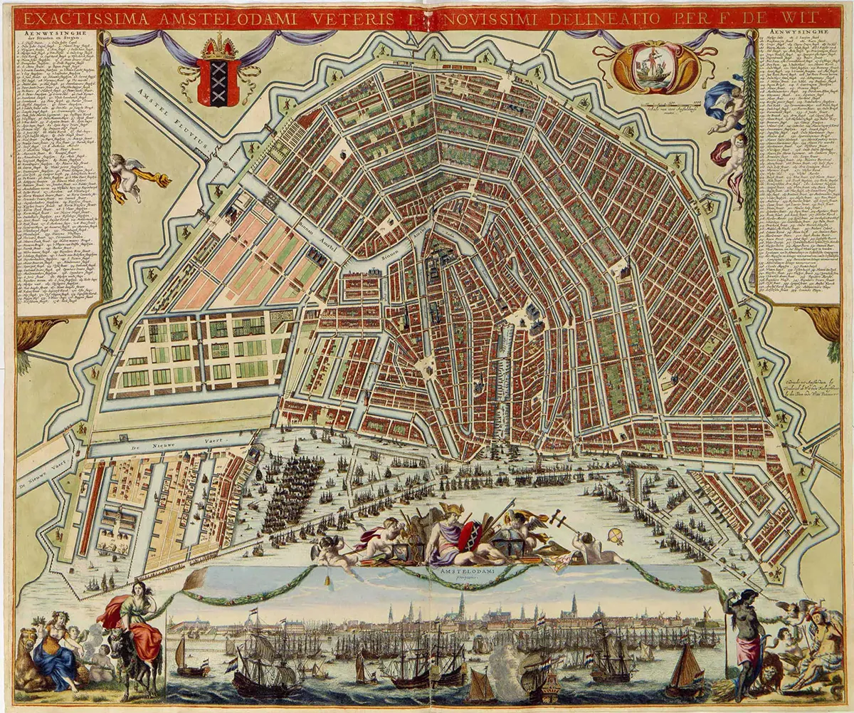
During the Fourth Expansion, the Herengracht, Keizersgracht, and Prinsengracht were extended from the Leidsegracht almost to the IJ. In the seventeenth century, the section from the Leidsegracht to the Amstel was built upon, and in the eighteenth and nineteenth centuries, the section between the Amstel and the IJ. After the Third and Fourth Expansions, there was enough space in the city to accommodate all new residents and industries.
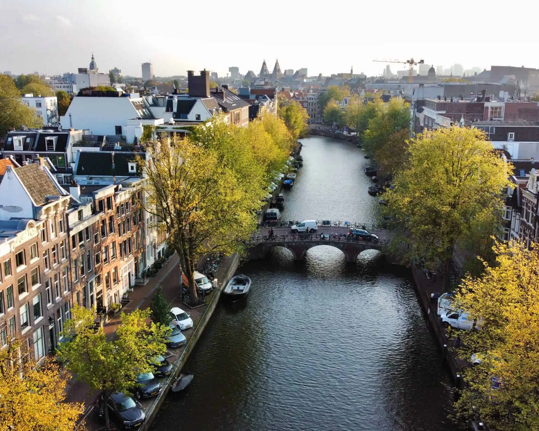
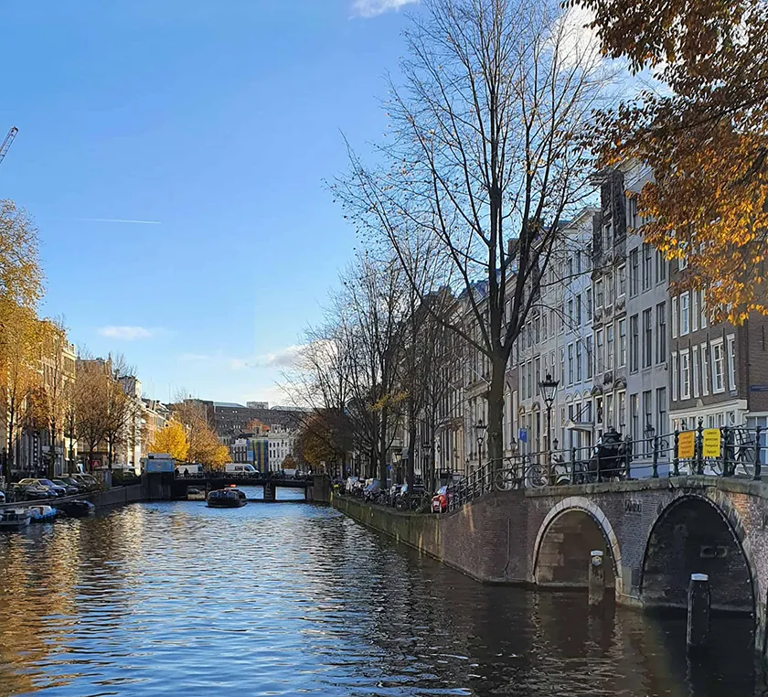
To this day, the image of the Amsterdam canal belt is world-famous and beloved by visitors from home and abroad. The many quay walls and bridges that the city possesses form the connection between the different parts of the city. Unfortunately, many bridges and quay walls in Amsterdam are in poor condition, requiring the City of Amsterdam to undertake major repairs on the bridges.
They must address approximately 850 bridges and 200 kilometers of quay wall, much of it in the city center, with the highest priority. This will take several years but will also offer opportunities for the city. This extensive operation can ultimately renew and green the quays and streets for the city.
The canalsHerengracht, Keizersgracht, Prinsengracht and Singel
 The canals
UNESCO World Heritage since 2010
 The canals
The Venice of the North